South Gondar Zone Administration

🌍 South Gondar Zone Administration

The Administration provides leadership, ensures good governance, and coordinates woreda administrations for peace, justice, and development.
• Governance & accountability
• Policy coordination
• Citizen participation
• Development planning

🏛️ Good Governance Office

📝 Transparency & Accountability
Promoting open government, access to information, and responsible leadership.

📊 Performance Monitoring
Tracking progress of projects and evaluating effectiveness of public services.

👥 Citizen Participation
Encouraging public involvement in decision-making and policy development.

⚖️ Rule of Law
Ensuring fairness, justice, and equal treatment for all citizens.

Community Affairs Office – Strengthens community participation

🤝 Strengthening the relationship between government and citizens.

📢 Listening to community concerns and feedback.

🌱 Promoting local development and participation.

🛠️ Supporting community projects and initiatives.

🕊️ Building peace, unity, and cooperation.

🎓 Education & 🏥 Health

🎓 Education & 🏥 Health

Description:
Education and health are the foundation of community development. The Zone focuses on accessible schooling and reliable healthcare.
• Expanding schools & literacy programs
• Quality healthcare services
• Teacher & health worker training
• Access to medicines & technology

🎓 Education Office – Primary, secondary, and TVET development.
Primary Education – Expanding access, improving literacy & numeracy skills, supporting inclusive learning for all children.

Secondary Education – Enhancing quality teaching, modernizing curricula, preparing students for higher education & life skills.

TVET (Technical & Vocational Education and Training) – Strengthening practical skills, fostering entrepreneurship, and aligning training with labor market needs.

• 🏥 Health Office – Hospitals, clinics, and preventive care.
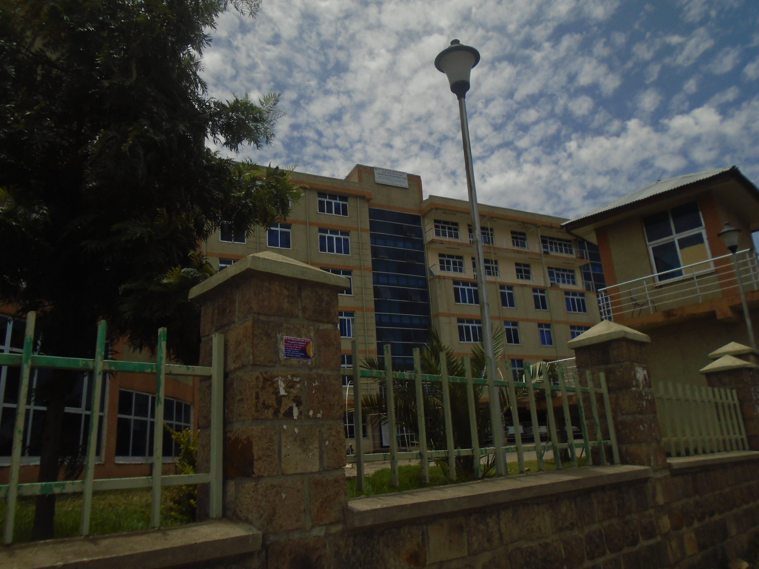
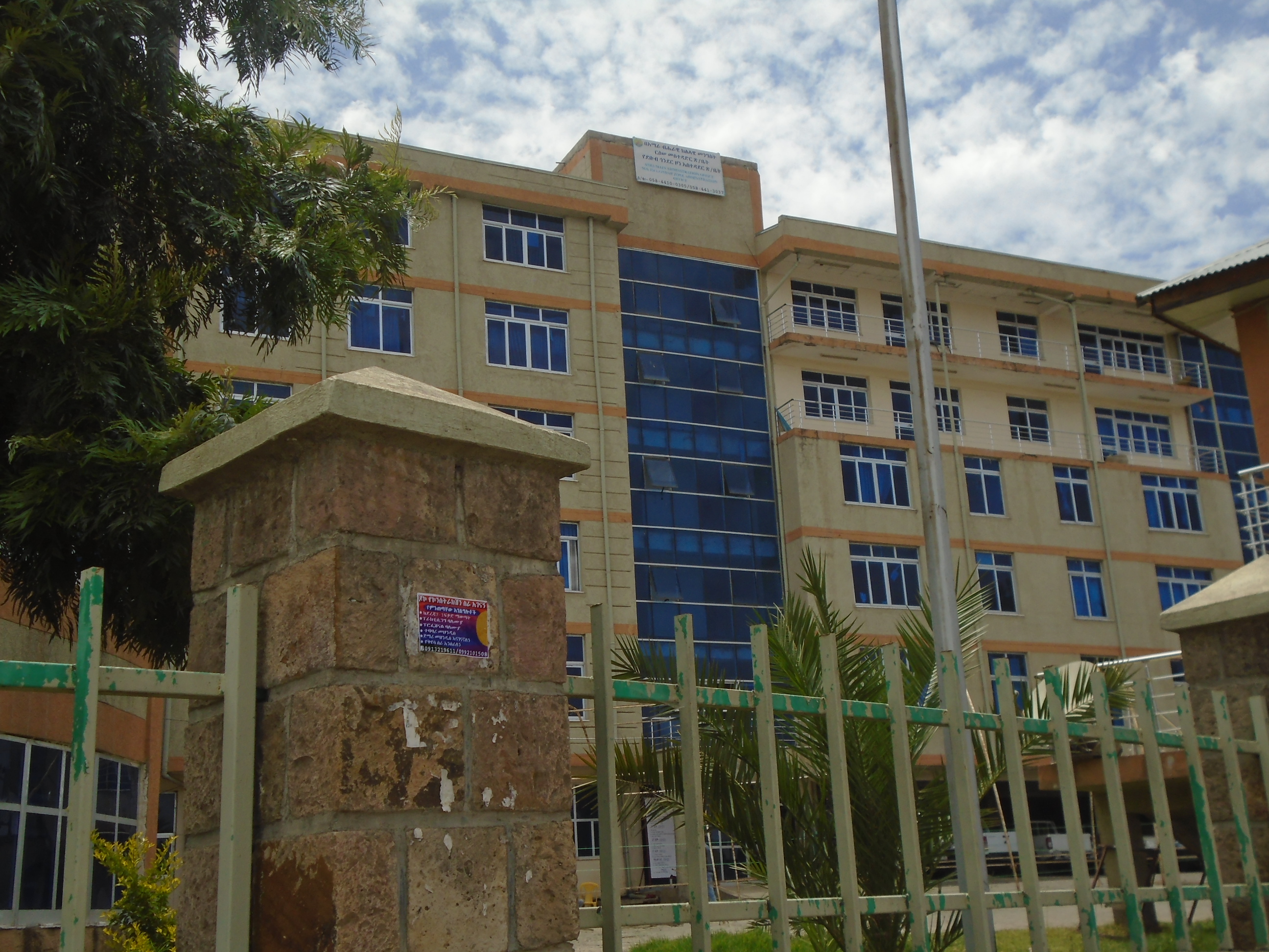
🏥 Hospitals – Providing inpatient and emergency medical services, specialized treatments, and maternal/child health care.

🏨 Clinics – Offering outpatient consultations, diagnostic services, vaccinations, and follow-up care.
🛡️ Preventive Care – Community health education, vaccination campaigns, sanitation programs, and disease prevention initiatives.

📞 Emergency Contact: [Insert hotline number]

🌍 Location & Coverage: Serving all communities within the zone.

Agriculture & Economy

🌱 Agriculture & 💰 Economy

Agriculture is the backbone of South Gondar’s economy, supported by modern farming, irrigation, and economic planning.
• Agricultural productivity increase
• Irrigation and water management
• Small business support
• Economic diversification

🌱 Agriculture Office – Crop, livestock, and extension services.

💰 Finance & Economy Office – Taxation, budget, and trade support.

🚧 Infrastructure & ⚖️ Social Development

🚧 Infrastructure &
⚖️ Social Development

Infrastructure development and social services build the foundation for long-term stability and prosperity.
Key Points:
• Road and transport construction
• Clean water & sanitation
• Social justice & equality
• Youth and women empowerment

🚧 Roads & Infrastructure Office – Roads, bridges, and energy.

⚖️ Women & Youth Office – Empowerment and inclusion.

previous arrow
next arrow

South Gonder Zone Government

The Government contributes to providing political guidance and exercising the executive function and regulatory powers. The Government provides significant economic policy guidance through its budget bill and related acts..

Image
Image
Image
Image

Information

Debub Gondar (or South Gondar) is a Zone in the Ethiopian Amhara Region. 

South Gondar is bordered on the south by East Gojjam, on the southwest by West Gojjam and Bahir Dar, on the west by Lake Tana, on the north by North Gondar, on the northeast by Wag Hemra, on the east by North Wollo, and on the southeast by South Wollo; the Abbay River separates South Gondar from the two Gojjam Zones.

The highest point in South Gondar is Mount Guna (4,231 meters). Towns and cities in this zone include Addis ZemenDebre Tabor and Wereta.

Latitude: 11° 39' 59.99" N
Longitude: 38° 00' 0.00" E

Nearest city : Debre Tabor